Hiking in Biliovo, Messinia
Walking in the so-called Biliovo, the amazing cobblestone path that connects the villages of Sotirianika and Altomira in Exo Mani, is an excellent experience for nature lovers and hikers. It has been designated as a monument of popular architecture by the Ministry of Culture.
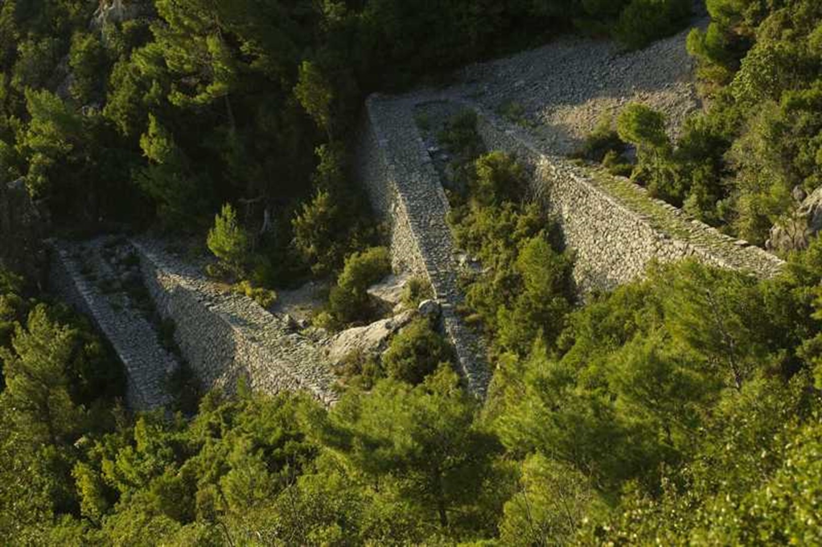
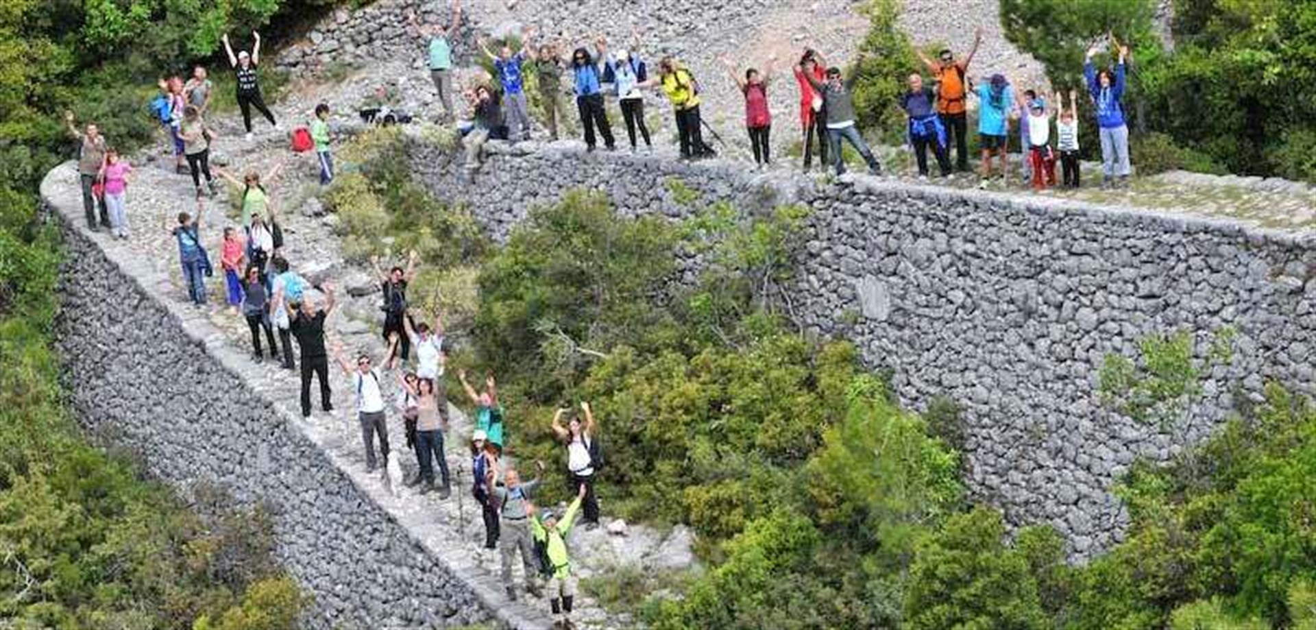
The stunning cobbled road from Biliovo in West Mani connects the main village of Sotirianika, at an altitude of 315 m, to the village of Altomira, at an altitude of 800 m. It was designated a monument of popular architecture by the Ministry of Culture. Its name comes from the Slavic word bȉlo (summit). The hike is not very difficult and will give you a memorable experience.
The construction of the cobblestones began in 1904 and is a real achievement of popular technique and architecture. It is part of a large network of cobblestones and paths used by the inhabitants of Mani and Taygetos until the middle of the 20th century. It was built with the collaboration of a civil engineer, local stone craftsmen and residents to connect the isolated settlement of Altomira with the rest of the villages of the Avia plain. The craftsmen had only the hammer and chisel as their basic tools! They were particularly skilled at quarrying the stone for both the cobblestones and the drystones that served as retaining walls, reaching up to 4 m in height. Connoisseurs will even notice that the level of the road is completely leveled, forming a regular slope and almost semi-circular turns.
From a date found carved in stone it appears that the work was finished in 1928.
Biliovo is considered one of the most beautiful cobblestones in Greece. According to the Hellenic Alpine Club of Kalamata, the remaining part of the ancient paved route is 3,000 m long and has eighty-three bends, seventy-eight of which have an angle of 150-180 degrees. It covers a total height difference of 500 meters and offers, from its highest points, an impressive view of the villages of Mani and the Gulf of Messinia. In some parts it climbs rocks and in others it crosses a stream.
Sotirianika is a large village built with the traditional Maniatian architecture. It consists of the settlements of Sotirianika, Haravgi, Kouris and Drosopigi. In Haravgi, on Petrovouni hill, stands out the great Castle of the Captains. In Mavrinitsa, southeast of Sotirianika, archaeologists have reported the existence of six Byzantine churches, probably the remains of a medieval settlement. Restored by the Archaeological Service, the Byzantine church of Agia Kyriaki stands next to a large threshing floor. The building, decorated with remarkable frescoes, dates from the second half of the 13th to the beginning of the 14th century. Archaeological remains, discovered by chance in 1938, indicate the existence of a Mycenaean colony in Sotirianika. Gold offerings were notably discovered in a mortuary pit.
The small village of Altomira, on the other hand, although very pretty, is deserted in winter. In 1999 it was designated a classified village, because of the 19th century houses, several of which have been restored and maintained, which line its streets. Nearby places of interest are the listed village of Margeli, the church of Agios Dimitrios from 1865 and the school building from 1875. In its stone fountains, crystal clear water flows in abundance and will quench your thirst after the walk. Around the village are old threshing floors, offering fascinating panoramic views. In the scattered stone fountains, the crystal water flows abundantly and will quench your thirst after walking.
Altomira is mentioned for the first time in 1618 and is then included in almost all censuses of the villages of Exo Mani. During the Turkish occupation, they belonged to the Captaincy and Exarchy of Zarnata, being a refuge for thieves.
(Sources: Hellenic Alpine Club of Kalamata, Athinorama, Ministère de la Culture, messinia.mobi).
Did you know that
At the Hellenic Alpine Club of Kalamata website you will see the path in detail. The total distance you will travel is 4.790m, the duration 1 hour and 30' (without stops).
Near Altomira is the Ridomou gorge.
Sotirianika is about 15 km from Kalamata.
Location
Find the destination on the interactive map below.
Σχετικό περιεχόμενο χρηστών (UGC)
Ενημερωθείτε για ενδιαφέροντα θέματα γύρω από τον προορισμό μέσα από το περιεχόμενο των χρηστών μας
Peloponnese. Greece beyond the obvious


Design and creation from Cosmote